Consortium
Coordinator
Dr Chris Danezis (Cyprus University of Technology)
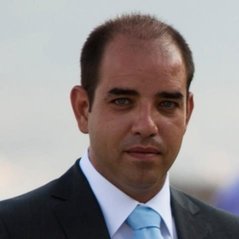 Dr Chris Danezis holds a Dipl. Ing. (5y) in Surveying Engineering from the National Technical University of Athens (NTUA), an MSc in Geoinformatics from the same university, and a PhD in Satellite Geodesy and Navigation from the University College London (UCL) Department of Civil, Environmental and Geomatic Engineering. Dr Danezis began his professional career immediately after completing his undergraduate studies. His first position (2002 – 2004) was a GIS & Database Architect, Programmer and Administrator in two cadastral and five rural cadastre projects. He was also involved as an Engineering Surveyor during the construction of major Olympic Venues in Athens, Greece. Between 2006 – 2007, he worked as a contracted researcher with UCL, where he was the principal researcher in the EU-funded FP6 program BEAR, which involved the development and implementation of a prototype animal tracking system. Dr Danezis designed a new positioning algorithm to augment GPS/GNSS, and increase system availability, accuracy, and reliability in GNSS-denied environments. He was also a consulting engineer in two more projects in collaboration with British Oil & Gas companies on Seismic and Hydrographic Surveying. In 2009, he was appointed as a Geodetic Infrastructure executive at the Hellenic National Mapping Agency (NCMA) in the department responsible for the operation of the Greek Permanent GPS/GNSS CORS Network (HEPOS). During his 5-year employment, he developed official software and services related to GPS/GNSS processing, coordinate transformations, and custom GIS extensions to automate geospatial infrastructure processes. Furthermore, he was a member of the Strategic Management Board initiated to reform and modernize the company structure. In September 2014, he was appointed as a tenure-track Lecturer in Geodesy at the Cyprus University of Technology (CUT) department of Civil Engineering and Geomatics. He is currently at the rank of Assistant Professor and serves as the Head of the Laboratory of Geodesy, Member of the Executive Committee and Infrastructure Coordinator of the ERATOSTHENES Centre of Excellence. Furthermore, he is the Coordinator of the CyCLOPS Strategic Research Infrastructure Unit, which involves the establishment of a permanent, continuously operating geohazards monitoring system using space-based techniques. CyCLOPS is comprised of eleven (11) permanent, state-of-the-art, high-rate GNSS receivers co-located with an array of specifically designed corner reflectors along with precise meteorological and geotechnical sensors. Additionally, Dr Danezis worked as a freelance consulting engineer for a 12y period. During his studies and career, he was won several professional and scientific scholarships and prizes, such as the 1st Prize for Best Degree Thesis awarded by the Technical Chamber of Greece (TCG), and the 1st Prize for Best Journal Publication in Geodesy for the years 2013 – 2014 awarded by the Academy of Athens. He has also served in the boards of Professional Bodies, such as the Cyprus Association of Rural and Surveying Engineers. His research focuses on the fields of Geodesy, Ubiquitous and Collaborative Positioning, Navigation, GNSS Augmentations, SAR, GIS, and Location-based Services. During 2012 – 2014 he was a member of the joint IAG – FIG committee (IAG 4.1.1 and FIG WG 5.5) on Ubiquitous Positioning. Moreover, he is a dedicated programmer of several conventional and AI programming languages, tools which he uses extensively in his research. He is the author of several peer-reviewed papers in leading international scientific journals and a reviewer in world-renowned scientific journals and conferences.
Advisory Board
Prof Vassilia Karathanassi (National Technical University of Athens)
 She is Professor of the School of the Rural and Surveying Engineering, specialised on the interpretation of radar and multi-band data for Earth Observation. She teaches multiple undergraduate and postgraduate courses, including Advanced Remote Sensing Topics, Remote Sensing & Applications, Environment and Development, Remote Sensing of Environment and Microwave Remote Sensing. Her international recognition is acknowledged in multiple aspects. For example, she is a reviewer in multiple high impact journals like IEEE Transactions on Geoscience and Remote Sensing, Journal of Remote Sensing, Computers in Industry, IEEE Geoscience and Remote Sensing letters, International journal of Geosciences and International Journal of Remote Sensing. Additionally, she is an evaluation for Research Grant of the Chilean country and she has been a member of 7 scientific committees (e.g. Conference on Remote Sensing and Geo-information of the Environment, 2018, and 5th International GEOBIA conference, 2014). She has further been invited as a keynote speaker to 9 international conferences since 2013. Finally, she has been invited as a Guest Editor for special issues in several journals, such as Journal of Marine Science & engineering (2018) and SciencePG (2016,2017). Since 2006, she has supervised more than 35 undergraduate, 5 masters and 8 PhD theses (4 of them completed) and 1 Post-Doctoral research. According to Scopus (Scopus Author ID: 6602927210), there are more than 667 citations in her published work. Furthermore, she is involved in more than 24 EU and national excellence/competitive research projects as a coordinator, as a principal investigator and as a researcher towards the design, development and validation of state-of-the-art methodologies and cutting-edge technology in Remote Sensing, Earth Observation and Computer Vision (e.g. H2020 and FP7).
Dr Athos Agapiou (Cyprus University of Technology)
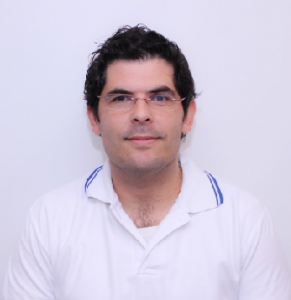 Dr Athos Agapiou is currently Researcher (Senior Researcher B’) at the Cyprus University of Technology. He obtained his Diploma from the School of Rural and Surveying Engineering at the National Technical University of Athens (2005), while two years later, he obtained an MSc in the field of Geoinformatics from the same university (2007). Also, he holds an M.A. from the Department of History and Archaeology of the University of Cyprus (2010). In 2013, he received his PhD in the field of Remote Sensing in Archaeology.
Throughout his studies, he has received several awards and scholarships. During the last years, Athos has been involved in several research projects at a European (H2020), regional (JPI-CH; Interreg) and local level (R.P.F.). For these research activities, he was granted with the Cyprus Research Awards Competition, “Young Researcher 2018”. Currently, he is acting as the Chair of the CAA-Gr (National Chapter of the ‘Computer Applications and Quantitative Methods in Archaeology’), National Delegate of Cyprus for “Space” in the Horizon 2020 EU Framework Programme for Research and Innovation, as well as reviewer at NASA Postdoctoral Program (NPP). His scientific interests include the fields of Earth Observation, Remote Sensing, G.I.S. and Geometric Documentation intended for archaeological research and cultural heritage landscapes.
Researchers
Dr Milto Miltiadou (Cyprus University of Technology)
 Dr Milto Miltiadou supports management of ASTARTE and played a substantial role in the proposal writing of this project. She is interested in forest monitoring, laser scanning, remote sensing, computer graphics, image processing and machine learning. She holds a BSc in Computer Science from University of Bristol, UK, and an MSc in Computer Animation and Visual Effects – a technical course about creating tools for 3D graphics – from Bournemouth University, UK. She further completed her Doctor of Engineering (EngD) at University of Bath, UK and the NERC Airborne Research Facility, Plymouth Marine Laboratory, UK, with a full studentship awarded by the Engineering and Physical Sciences Research Council (EPSRC) through the Centre for Digital Entertainment, where she specialised on “Efficient analysis and visualisation of full – waveform LiDAR data with applications to forestry”. She worked on project s that includes interpreting and/or co – registrating multi – band, radar, terrestrial laser scanning, hyperspectral data and time – series analysis. She got involved into proposal writing and supporting project management. It is noticeable that she gain ed experience in both academia and industrial innovation through her placements at the Remote Sensing group of Plymouth Marine Laboratory (UK), Planetek Hellas (GR) and two forestry companies: Carbomap (UK) and Interpine Group Ltd (NZ). She was further invited to give lectures at the National Institute of Space Research (INPE), Brazil and University of Bari, Italy and reviewed papers for the MDPI Remote Sensing and MDPI Sensors journals. Additionally, she has gained significant professional skills through extra – curricular activities, which include organising writing retreats, collecting student feedback, and attending the departmental and faculty board meetings. Her performance has been acknowledged with multiple awards including Silvilaser Poster competition and being selected as a finalist for the prestigious EDE & Ravenscroft award that recognises the work of the best postgraduate researcher annually.
Christos Theocharidis (Cyprus University of Technology)
 Christos Theocharidis is a Forester-Environmentalist, with Master of Science in “Geoinformatics and Geospatial Technologies” from the Department of Civil Engineering and Geomatics of Cyprus University of Technology, where he is currently a PhD Candidate in “Remote Sensing and Earth Observation”. He has completed his undergraduate degree at the Democritus University of Thrace in the Department of Forestry and Management of the Environment and Natural Resources. His research interests focus on observing the environment for both land and ocean related applications by using remote sensing technologies (including both multi-band and radar data). He is also familiar with processing remote sensing satellite data in GIS software like ArcMap, ArcGis Pro, QGIS, SNAP and he is learning how to use python programming to automate and ease processing of big data. It worth mentioning that he used to be firefighter volunteer and his training made him a highly motivated person and very passionate about protecting the environment. He is, therefore, interested in using his academic background for tackling environmental related issues (e.g. understanding the effects of climate change and using them as evidence to promote environmentally friendly policies). During both his undergraduate and postgraduate studies, Christos acquired important skills in Cartography, Remote Sensing and Geographic Information Science. He is further a very highly motivated person willing to keep learning and continuously improving his skills.
Viktoria Kristollari (National Technical University of Athens)
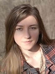 Viktoria Kristollari is a researcher and PhD candidate at the Remote Sensing Lab (RSLab) of National Technical University of Athens (NTUA). She is also a teaching assistant at the course “Special Topics of Remote Sensing”. She completed her BSc and Integrated MSc studies in Rural and Surveying Engineering at NTUA in 2016 (ranked 2nd ) and received the Excellence Award of the Limmat Stiftung foundation. During her master studies in the framework of a medical research project she developed an automatic hyperspectral method for the detection and scoring of the erythema parameter of psoriasis disease. Since 2017 she has worked as a researcher at the NTUA RSLab in the field of multispectral and hyperspectral data processing. She was involved for a year in the MARERIAL project where she collected and analyzed hyperspectral data of urban construction materials in Athens and Munich for the development of a deep learning classification product for Calcon GmbH. She also participated for a year in the SEO-DWARF project (MSCA-RISE) where she contributed to the implementation of the marine Remote Sensing algorithms. During the project she was seconded for 3 month periods to Cloudsigma (Sofia), TWT (Stuttgart), Planetek Italia (Bari) and i-Sea (Bordeaux). Her PhD research which has been granted a 3 year scholarship by the NTUA Research Committee, concerns the investigation and development of classification methods on multispectral/hyperspectral imagery with focus on the use of neural network architectures. She is an experienced user of Remote Sensing, Photogrammetric and GIS software packages (ESA SNAP, ENVI, ERDAS ER Mapper, Photomod, Photoscan, ArcGIS, QGIS) and possesses programming skills in Python and Matlab.
Efrosyni Antoniou (Friends of the Earth Cyprus)
 Efrosyni Antoniou is a Project Manager at the Friends of the Earth Cyprus. She completed her MSc studies in Urban Environmental Management, at Wageningen University (Netherlands) in 2013 and her BSc studies in Agriculture at Aristotle University of Thessaloniki (Greece) in 2006. Since then, she has worked as a researcher/ consultant for Alterra Research Institute (Wageningen Research Center, Netherlands) and UNESCO, as a lecturer for KES College (Cyprus), as an accredited consultant for Garden-Masters Ltd (Cyprus) and as an agriculturist for Greentech Trading Ltd (Cyprus). During those years she has developed skills for efficient project management, research development, research reports’ writing, staff coordination, academic teaching, administration and increasing the awareness of society and stakeholders for environmental issues. She cooperated with local authorities, communities and multidisciplinary teams of experts to achieve goals for sustainability transition and the creation of climate resilience islands, urban and rural areas. Furthermore, she is a member of the Project Management Institute (PMI/ USA), of the Chartered Institute of Horticulture (CIH/ UK) and the Cyprus Board of Agriculturists. She has been involved as a researcher in two funded research projects: The «INTERREG IV-B Project Future Cities» from 2009-2012 and the UNESCO’s global project “On the Frontlines of Climate Change: A Forum for Small Islands and Vulnerable Communities” from 2010-2013. Her main research interests is the sustainability transition of our society and the creation of climate resilience environments.
Dr Polychronis Kolokoussis (National Technical University of Athens)
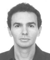 Dr. Polychronis Kolokoussis, holds a Diploma in Rural and Surveying Engineering from NTUA (1993) and a PhD Degree from NTUA (2008). Since 1998, he is senior research assistant at the Remote Sensing Laboratory, School of Rural and Surveying Engineering, NTUA. He participates in lectures on Remote Sensing at the under and post graduate level and has significant expertise in the fields of Photo-Interpretation, Remote Sensing, Digital Image Processing, their applications and their integration with GIS. During the last years his research interest has been focused on acquisition and processing of hyperspectral and thermal remote sensing imagery as well as object-based image analysis, with emphasis on techniques used for identifying changes and protecting the natural environment. He has published his work in several international journals and conferences and has participated in more than twenty National and European Research Projects. He is reviewer in many international journals e.g. Springer, Elsevier, Taylor & Francis, Wiley, MDPI and Bowen, as well as evaluator of H2020 Earth Observation proposals.

